


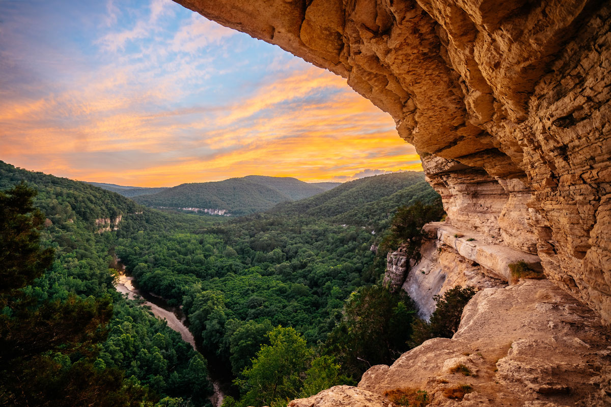
Nothing says summer like grabbing your keys and hitting the road. And when you have the Ozark Mountains as neighbors, you’re never more than a short, scenic drive from the clear rivers, mountain forests, and towering bluffs that make "The Natural State" more than a nickname.
So pack your boots, queue up a playlist, and plan your next adventure with the best single-day road trips from Fayetteville.
Best Waterfalls Near Fayetteville
Some of the state’s best water features are just a short drive from the city. Keep an eye on the forecast, because when the rain hits, these waterfalls are well worth—wait for it—chasing.
Kings River Falls Natural Area
Best for: Easy strolling, families, and summer swimmers.
Drive time: ~1 hour east (near Witter)
The Kings River is a bit of an anomaly in the Ozarks because it flows from south to north (a fun fact for the hydrology nerds out there). Along its banks runs a flat, easy-to-follow 1.8-mile round-trip trail where you’ll spot scenic cascades, bluffs, caves, diverse plants, and wildflowers in the spring.
This mellow trail keeps things breezy, making it a perfect option for little ones or anyone more interested in a refreshing dip than a grueling workout. The ultimate payoff is, of course, the 10-foot Kings River Falls and its popular summer swimming hole. Whether you want to float, fish, or lounge on the smooth rocks lining the pool, it's a stellar spot to pack a picnic and disconnect for the day.
Local Tips
- Be prepared for a few miles of bumpy gravel county roads just before you reach the trailhead parking lot.
- This is a dog-friendly spot for leashed pups, but keep in mind there is a small metal grate bridge on the path that some pups can be shy about crossing.
Glory Hole Falls
Best for: Hikers and waterfall-chasers who don't mind a challenge.
Drive time: ~1.5 hours southeast (near Boxley Valley)
Glory Hole Falls is one of the most recognizable landmarks in Northwest Arkansas. To see it, you'll tackle a scenic two-mile round-trip hike that saves its real leg-burning workout for the way back up as you climb 500 feet of elevation in a single mile.
This unique waterfall relies entirely on a seasonal stream, meaning recent rainfall is the secret ingredient to seeing it in action. When it's flowing, the water plunges 30 feet straight through a perfectly round hole carved into an overhanging rock ceiling, dropping into a massive, amphitheater-like bluff shelter.
Local Tips
- For parking, keep your eyes peeled for a small, unpaved gravel pull-off right off Highway 16, a few miles south of Edwards Junction. There are no official signs, so it's easy to miss.
- Wear sturdy, closed-toe hiking boots. The trail crosses small streams and can get muddy and slick.
Eden Falls and the Lost Valley Trail
Best for: Adventurous hikers and explorers.
Drive time: ~1.5–2 hours southeast (near Ponca).
This one’s for the adventurous. Eden Falls in the Buffalo National River corridor is the grand finale to the Lost Valley Trail: a two-mile out-and-back route.
The route begins as an easy-to-moderate stroll from the parking area, gently winding up a box canyon beneath groves of American beech trees. Along the way, you'll see the Natural Bridge, a 50-foot-long tunnel made of worn-away limestone, before climbing stone steps past the massive, 200-foot bluff shelter known as Cob Cave.
The crown jewel of the trek is Eden Falls, a picturesque 53-foot cascade tumbling over towering cliffs. If you have a flashlight and don't mind getting your hands dirty, you can scramble up a rugged, steep spur trail to the mouth of Eden Falls Cave. Crawl inside, and you'll find a 25-foot underground waterfall hiding in the darkness.
Local Tips
- The rocks and bluffs here can be slick and are common spots for slips and rescues. Stay on the main trail and watch your footing to keep the adventure fun.
- Pack a flashlight or headlamp if you plan to head inside the cave.
- This trail is a protected habitat, so pets need to skip this one. Service animals are always welcome.
Buffalo National River
Best for: Everyone! Paddlers, hikers, wildlife watchers, you name it.
Drive time: ~1.25 to 2 hours east (entry points in Harrison, Jasper, and Ponca).
There’s no better place to go with the flow. Protected in 1972 as America’s very first National River, this 135-mile ribbon of water runs free and undammed through the Ozark Mountains. This is a place of endless adventure, from hiking and swimming to kayaking, fishing, and stargazing. Keep your eyes peeled while you explore: the area is home to the state’s only wild elk herd, with about 450 of them roaming the river valleys.
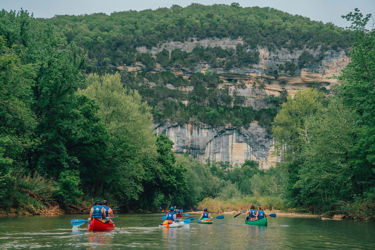
Because this massive park covers a whole lot of land, there isn't a single "main entrance." Instead, it's divided into three distinct districts accessed by different highways.
The Upper District
The remote and rugged Upper District is famous for its towering limestone bluffs, waterfalls, and excellent hiking, including the Lost Valley Trail and Eden Falls. In the spring, heavy rains turn this stretch into a destination for whitewater kayakers and paddlers.
The Middle District
If you love a relaxed day on the water, you'll love the Middle District. Centered around the Tyler Bend Visitor Center, this stretch is known for its idyllic, family-friendly paddling conditions, plus scenic hiking trails, historic sites, and excellent fishing—especially smallmouth bass.
The Lower District
Home to the park’s largest wilderness area, the Lower District features calm waters and deep pools. It offers reliable summer floating when the upper stretches get too low, winding past massive bluffs that overlook broad, rolling Ozark Mountain valleys.
Local Tips
- Floating the Buffalo River is popular, so you’ll want to plan ahead and book your gear early. The river’s three districts are served by authorized concessioners and outfitters who can set you up with everything you need to get out on the water. Check out the Buffalo River Concessioners Guide to find an outfitter in the area you plan to explore.
- The Buffalo is a free-flowing river, meaning the water levels dictate whether you can float. Always check the official NPS River Levels before you head out.
- Expect limited cell service. Download or print your offline maps, driving directions, and trail guides before you leave home.
Devil's Den State Park
Best for: Mountain bikers, hikers, horseback riders, and history buffs.
Drive time: ~30–35 minutes south (West Fork).
Down in the Lee Creek Valley, Devil's Den State Park is a natural playground. It's home to a premier stretch of Arkansas’s world-class Monument Trails—a shared-use network specifically designed to highlight the park's rugged terrain. Welcoming riders, hikers, and trail runners of all skill levels, this network is part of the system that Outside Magazine named the best mountain biking in the U.S in 2023.
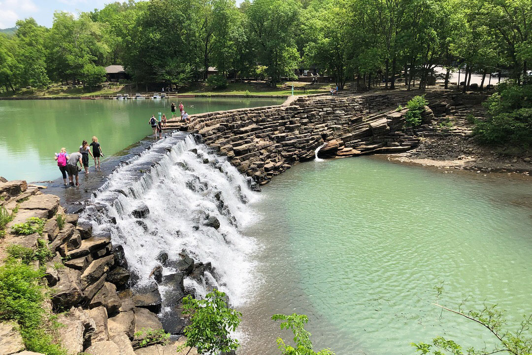
The geology here is fascinating, characterized by deep sandstone crevices, natural caves, and massive rock tumbles. While the caves themselves are closed to protect native bat populations, the trails that weave around them are legendary.
For Hikers: The Yellow Rock Trail is a must-do, leading you to a massive stone overlook with a panoramic view of the valley below. If you're looking for a backpacking challenge, the 15-mile Butterfield Hiking Trail loops deep into the surrounding Ozark National Forest.
For Bikers: Devil's Den is home to the historic Fossil Flats, the first mountain biking trail in Arkansas State Parks. The coolest part? True to its name, you can actually spot fossils embedded in the exposed rock of the creek bed along this loop.
For a Slower Pace: You can rent a pedal boat to cruise around the eight-acre Lake Devil, cast a fishing line into Lee Creek, and find designated horse trails on the seven-mile Gorley King Trail.
Local Tips
- Gas stations and grocery stores are scarce within a 20-mile radius of the park, so fill your tank and grab your snacks before leaving.
- Wear broken-in, closed-toe hiking boots with good grip. Many of the trails are rocky, steep, and involve climbing stairs.
Hobbs State Park-Conservation Area
Best for: Cross-country bikers, trail runners, water lovers, families, and adaptive hikers.
Drive time: ~35–40 minutes northeast (Rogers).
Hobbs State Park is all about wide-open spaces. It's the largest state park in Arkansas, spanning 12,000 acres of forested hills along the turquoise waters of Beaver Lake. The park’s 54-mile trail system gives hikers, bikers, and horseback riders plenty of room to explore. It’s also a welcoming spot for families, strollers, and adaptive hikers thanks to two ADA-accessible paths: the Ozark Plateau Trail and the Historic Van Winkle Trail.
Among the park's best routes is the renowned Karst Loop, a portion of the state's Monument Trail system that offers world-class singletrack for riders. If you prefer the water to the woods, park interpreters lead guided kayak tours along the quiet fingers of Beaver Lake from May to October.
What makes Hobbs truly unique is its ecological mission. The park actively protects crucial habitats for diverse Ozark flora and fauna, including several species of endangered bats. You can take a closer look at these conservation efforts at its beautiful visitor center and interactive exhibits.
Local Tips
- Since trails are shared, stay alert, know that bikers often travel at high speeds, and check the Friends of Hobbs site for trail closures during hunting season.
- This is a dog-friendly spot for leashed pups.
Lincoln Lake
Best for: Rock climbers, boulderers, trail runners, and paddleboarders.
Drive time: ~30–35 minutes west (Lincoln).
If you’re looking to sneak away from the city without spending your whole afternoon in the car, Lincoln Lake is the perfect little escape. Just thirty minutes west of town, this 400-acre spot is officially a city park, but it feels much more like a backcountry oasis. At its heart is a 90-acre lake surrounded by thick pine groves, hardwood forests, and big limestone bluffs.
A hand-built trail system wraps the lake and lets you set your own pace. You can keep it easy with a flat ride under the canopy, climb higher for bluff-top views (and the occasional eagle), or head into more rugged, technical loops.
If you want to get on the water, it’s a peaceful spot for kayakers, paddleboarders, and anglers since motorized boats and jet skis aren't allowed. It’s also a favorite destination for local rock climbers and boulderers, thanks to a legendary "great wall" of bluffs right by the trails.
If you really want to treat yourself, time your visit for sunrise or sunset.
Local Tips
- Only paddlecraft (kayaks, canoes, paddleboards) and electric trolling motors are allowed on the water.
- This is a dog-friendly spot for leashed pups.
Fayetteville, Arkansas Road Trip FAQs
When is the best time of year to see waterfalls near Fayetteville?
The best time to catch Arkansas waterfalls at their most impressive is during the spring months (March through May), when seasonal rainfall keeps the creeks rushing. Late autumn and winter can also offer great views after a steady rain.
Are park passes or entry fees required for these day trips?
One of the best things about exploring Northwest Arkansas is that admission to all Arkansas State Parks (like Devil's Den and Hobbs) and the Buffalo National River is completely free. Lincoln Lake and Kings River Falls also offer free public access, making these day trips incredibly budget-friendly.
Do I need a four-wheel-drive vehicle to reach these trailheads?
For all the destinations featured in this guide, a standard two-wheel-drive vehicle or sedan will do the trick. Major destinations like Devil’s Den, Hobbs State Park, and the Lost Valley Trail feature paved roads and well-maintained parking areas. Just take it slow if you encounter a gravel pull-off or roadside parking area.
Will I have cell phone service while out on the road trips?
Cell service is generally excellent along the I-49 corridor, but it becomes very spotty or completely nonexistent once you drop into the deeper valleys of the Ozark National Forest and the Buffalo National River.
What should I pack for a day trip from Fayetteville?
Weather in the Ozarks can shift quickly, so bring water, snacks, sunscreen, and layers. Waterproof boots are worth it for Glory Hole Falls and Eden Falls Cave. Bring a flashlight if you're planning to explore Eden Falls Cave. And always check trail conditions before you leave.
Marketing assets for the Buffalo National River provided by the Buffalo Outdoor Center (outfitter). Photos by Jeff Rose.

